Home | Category: Coastal Areas
COASTAL AREAS

Coast of Samoa
Two thirds of all commercially-harvested fish depend at some point in their life on coastal wetlands, sea grasses or coral reefs.
Large numbers of people also live in coastal areas and their numbers are rising. In some countries more than half the population lives in coast areas and enterprises in the coastal area account for more than half of the country’s wealth. The presence of all these humans is causing strains on coastal ecosystem and the life forms that live there.
Mangrove forests, salt marshes and sea grass beds cover less than 1 percent of the world’s seabeds but they lock away well over half of all carbon buried in the ocean floor. They store an estimated 1.65 billion tons of carbon dioxide every year — nearly half of the global transport emissions — making them one of the most valuable carbon sink on Earth.
Mangrove forests, salt marshes and sea grass beds may lock away between 50 and 70 percent of the organic carbon in the ocean. Sea grass meadows alone account for 15 percent of the ocean’s total carbon storage. Underwater forests of kelp hold huge amount of carbon just as forest do on land. According to a United Nations report: “The carbon burial capacity of marine vegetated habitats is phenomenal, 180 times greater than the average burial rate in the open ocean.”
Frank Pope wrote in Times of London, “Salt marshes are the most effective carbon sinks, with long-term storage power ten times that of undisturbed Amazonian rain forest. Mangroves and sea grass beds store six and two times as much, respectively.”
Related Articles: ISLANDS: TYPES, HOW THEY FORM, FEATURES AND NATIONS ioa.factsanddetails.com ; BEACHES: SAND, SURF AND FOAM ioa.factsanddetails.com ; BEACH SAFETY, DANGERS AND HAZARDS ioa.factsanddetails.com ; TIDAL POOLS, INTERTIDAL ZONE AND LIFE FOUND THERE ioa.factsanddetails.com ; SEAGRASS— FEATURES, ECOSYSTEMS AND THE WORLD’S OLDEST AND BIGGEST PLANTS ioa.factsanddetails.com ; WETLANDS, MARSHES AND ESTUARIES ioa.factsanddetails.com ; MANGROVES: CHARACTERISTICS, CONSERVATION AND ROLE IN CLIMATE CHANGE ioa.factsanddetails.com
Websites and Resources: National Oceanic and Atmospheric Administration (NOAA) noaa.gov; “Introduction to Physical Oceanography” by Robert Stewart , Texas A&M University, 2008 uv.es/hegigui/Kasper ; Woods Hole Oceanographic Institute whoi.edu ; Cousteau Society cousteau.org ; Monterey Bay Aquarium montereybayaquarium.org
RECOMMENDED BOOKS:
“The Beach Book: Science of the Shore” by Carl H Hobbs (2012) Amazon.com
“Waves, Tides and Shallow-Water Processes” Open University(1989) Amazon.com
“Tides: The Science and Spirit of the Ocean” by Jonathan White Amazon.com
“Waves and Beaches: The Powerful Dynamics of Sea and Coast” by Willard Bascom 2021) Amazon.com
“Waves in Oceanic and Coastal Waters” by Leo H. Holthuijsen (2007) Amazon.com
“Surf Science” by Tony Butt (2004) Amazon.com
“The Wave: In Pursuit of the Rogues, Freaks, and Giants of the Ocean” by Susan Casey (2010) Amazon.com
“Ecology of Coastal Waters: With Implications For Management” by K. H. Mann Amazon.com
“The World of the Salt Marsh: Appreciating and Protecting the Tidal Marshes of the Southeastern Atlantic Coast” by Charles Seabrook (2013) Amazon.com
“Fylling's Illustrated Guide to Pacific Coast Tide Pools” by Marni Fylling Amazon.com
“The Biology of Mangroves and Seagrasses” by Peter J. Hogarth Amazon.com
“The Botany of Mangroves” by P. Barry Tomlinson Amazon.com
“Introduction to Coastal Engineering and Management” by J William Kamphuis Amazon.com
“Introduction to Coastal Processes and Geomorphology” by Robin Davidson-Arnott, Bernard Bauer, et al. Amazon.com
“Physical Oceanography of Coastal and Shelf Seas” by B. Johns Amazon.com
“Coastal And Estuarine Processes” by Peter Nielsen Amazon.com
“Descriptive Physical Oceanography” by Lynne Talley (2017) Amazon.com
“Essentials of Oceanography” by Alam Trujillo and Harold Thurman Amazon.com
“The Blue Machine: How the Ocean Works” by Helen Czerski Amazon.com
“How the Ocean Works: An Introduction to Oceanography” by Mark Denny (2008) Amazon.com
“The Unnatural History of the Sea” by Callum Roberts (Island Press (2009) Amazon.com
“Blue Hope: Exploring and Caring for Earth's Magnificent Ocean” by Sylvia Earle (2014) Amazon.com
“National Geographic Ocean: A Global Odyssey” by Sylvia Earle (2021) Amazon.com
Coastal Processes and Tides
Ocean phenomena such the transformation of waves as they come ashore and break; the currents and edge waves generated by the interaction of waves with coasts; tsunamis; storm surges; and tides, especially tides along coasts and in the deep ocean all have an impact on shorlines and coastal areas. Several of these are worth a closer look according to the “Introduction to Physical Oceanography” are: 1) Waves propagating into shallow water are refracted by features of the seafloor, and they eventually break on the beach. Breaking waves drive near-shore currents including long-shore currents, rip currents, and edge waves. 2) Storm surges are driven by strong winds in storms close to shore. The amplitude of the surge is a function of wind speed, the slope of the seafloor, and the propagation of the storm. 4) Tides are important for navigation; they influence accurate geodetic measurements; and they change the orbits and rotation of planets, moons, and stars in galaxies. [Source: Robert Stewart, “Introduction to Physical Oceanography”, Texas A&M University, 2008]

Southeastern United States continental shelf 4) Tides are produced by a combination of time-varying gravitational potential of the moon and sun and the centrifugal forces generated as earth rotates about the common center of mass of the earth-moon-sun system. 5) Tides have six fundamental frequencies. The tide is the superposition of hundreds of tidal constituents, each having a frequency that is the sum and difference of five fundamental frequencies. 6) Shallow water tides are predicted using tide measurements made in ports and other locations along the coast. Tidal records of just a few months duration can be used to predict tides many years into the future.
7) Tides in deep water are calculated from altimetric measurements, especially Topex/Poseidon measurements. As a result, deep water tides are known almost everywhere with an accuracy approaching ±2 centimeters. 8) The dissipation of tidal energy in the ocean transfers angular momentum from moon to earth, causing the day to become longer. 9) Tidal dissipation mixes water masses, and it is a major driver of the deep, meridional-overturning circulation. Tides, abyssal circulation, and climate are closely linked.
Watersheds
A watershed is a land area that channels rainfall and snowmelt to creeks, streams, and rivers, and eventually to outflow points such as reservoirs, bays, and the ocean. While some watersheds are relatively small, others encompass thousands of square miles and may contain streams, rivers, lakes, reservoirs, and underlying groundwater that are hundreds of kilometers inland.
The size of a watershed (also called a drainage basin or catchment) is defined on several scales — referred to as its Hydrologic Unit Codes (HUC) — based on the geography that is most relevant to its specific area. A watershed can be small, such as a modest inland lake or a single county.
Conversely, some watersheds encompass thousands of square miles and may contain streams, rivers, lakes, reservoirs, and underlying groundwater that are hundreds of miles inland. The largest watershed in the United States is the Mississippi River Watershed, which drains 3 million square kilometers (1.15 million square miles) from all or parts of 31 U.S. states and two Canadian provinces stretching from the Rockies to the Appalachians!
Water from hundreds, and often thousands, of creeks and streams flow from higher ground to rivers that eventually wind up in a larger waterbody. As the water flows, it often picks up pollutants, which may have sinister effects on the ecology of the watershed and, ultimately, on the reservoir, bay, or ocean where it ends up.
Not all water flows directly to the sea, however. When rain falls on dry ground, it can soak into, or infiltrate, the ground. This groundwater remains in the soil, where it will eventually seep into the nearest stream. Some water infiltrates much deeper, into underground reservoirs called aquifers. In other areas, where the soil contains a lot of hard clay, very little water may infiltrate. Instead, it quickly runs off to lower ground.
Rain and snowmelt from watersheds travel via many routes to the sea. During periods of heavy rain and snowfall, water may run onto and off of impervious surfaces such as parking lots, roads, buildings, and other structures because it has nowhere else to go. These surfaces act as "fast lanes" that transport the water directly into storm drains. The excess water volume can quickly overwhelm streams and rivers, causing them to overflow and possibly result in floods.
Barrier Islands, Bights and Deltas
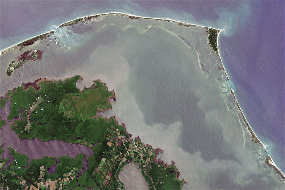
Cape Hatteras and the Outer Banks of North Carolina
Barrier islands are a first defense against rising sea levels and storms. Comprised of sand dunes that create a sort transition zone between land and sea, they block storm surges that could seriously damage inland coastal cities.
Barrier islands have been greatly damaged by human occupation. Overgrazing of grass by animals has caused erosion. House and building construction has crowded and degraded the crucial zone near the sea and destroyed habitats for numerous creatures.
A bight is a long, gradual bend or recess in the shoreline that forms a large, open bay. Bights are shallow and may pose hazards to navigation, so their depths, in addition to any submerged features like sand bars and rock formations, are clearly marked on nautical charts. A number of bights can be found on both the U.S. West and East Coasts. The Southern California Bight, for example, is the curved coastline between Point Conception and San Diego, and encompasses the Channel Islands. The New York Bight refers to the coastal area between Long Island and the New Jersey coast. It is part of a larger geographical area called the Middle Atlantic (or Mid-Atlantic) Bight, which extends from Cape Hatteras, North Carolina, north to Cape Cod, Massachusetts. One of the world's largest bights is the Great Australian Bight on the continent's southern coast.
A delta is a place where silt collects and strips of land are created where a river empties into the sea. About 700 million people live in and around the world’s deltas with particularly large masses living around the Nile Delta, Mekong Delta, Yangtze Delta, Rhone Delta, Mississippi Delta, Chao Phraya Delta in Thailand, Irrawaddy Delta in Myanmar and the Ganges Delta. A study based on satellite imagery published in 2009 in the journal Nature Geoscience indicated that 85 percent of the 33 largest delta regions experienced severe floods during the previous decade, affecting 260,000 square miles. The situation is being exacerbated by sinking land in the deltas caused by agriculture, development, damming over rivers, petroleum and natural gas extraction and the pumping of groundwater as well as rising sea levels associated with global warming.
Lagoons
Lagoons are bodies of water separated from larger bodies of water by natural barriers such as sandbars, barrier reefs and coral reefs. The word "lagoon" derives from the Italian word laguna, which means "pond" or "lake." [Source: NOAA]
Although lagoons are well defined geographically, the word “lagoon” is sometimes used as a name for a larger region that contains one or more lagoons. For example, Laguna Madre on the Texas Gulf Coast is actually made up of smaller bays and lagoons, while Laguna Beach in Southern California is actually a beach and not a lagoon at all.
There are two types of lagoons: atoll and coastal. Atoll lagoons form when an island completely subsides beneath the water, leaving a ring of coral that continues to grow upwards. At the center of the ring is a body of water that is often deep. The combination of coral growth and water creates a lagoon. It may take as long as 300,000 years for an atoll formation to occur.
Coastal lagoons form along gently sloping coasts. They are generally shallower than atoll lagoons and tend to be separated from the ocean by an island, reef, or sand bank. Most of the time, coastal lagoons are connected to the ocean by an inlet.
Sea level rise, the amount of existing sediment, and tidal range all contribute to the formation of coastal lagoons. Younger and more dynamic than atoll lagoons, coastal lagoons may have shorter “lifespans” due to their exposed locations on the shore.

Oceanic divisions
Anchialine Pools
The word “anchialine” (AN-key-ah-lin) comes from a Greek word meaning “near the sea." These typically small pools, which form in limestone or volcanic rock, are located throughout the world but are most common in the Hawaiian Islands and on Mexico’s Yucatán Peninsula. [Source: NOAA]
Anchialine pools have their own unique ecosystems populated by tiny and often rare species of crustaceans, fish, and eels. Among these species is Hawaii’s legendary red shrimp, the ʻōpaeʻula (oo-PAY-oo-la). Water levels in the pools can fluctuate in response to ocean tides. Due to their subterranean connection to the ocean, anchialine surface waters are often brackish and become more saline (salty) with increasing depth.
Many anchialine pools are found in underground cave systems and are favorite destinations for cave divers seeking to observe unusual cave species. One such creature is the Mexican blind tetra, an albino fish that has lost not only its sight but also its eyes!
More than half of the world’s known anchialine pools are found in the Hawaiian Islands. On the Big Island of Hawaii, the NOAA Restoration Center funded a two-acre restoration project for the pools, which have fallen victim in recent years to invasive fish species that upset the pools’ natural balance. To restore the ponds, nearly 400 citizen volunteers helped remove the foreign invaders and reintroduce native vegetation. The restored sites are monitored twice a month to remove algae and maintain the revitalized vegetation. Scientists are learning that the pools’ fragile natural balance makes them good indicators of overall coastal ecosystem health.
Rocky Shorelines
Kevin Short wrote in the Daily Yomiuri, “Rocky shorelines are among the most diverse of all temperate zone marine habitats. The rocky coast environment develops where hills or mountains march right down to the sea. Waves constantly pound the shoreline, breaking off huge chunks of granite or sandstone, and in some places carving sheer vertical cliffs. [Source: Kevin Short, Daily Yomiuri, July 21, 2011. Short is a naturalist and cultural anthropology professor at Tokyo University of Information Sciences.]
The rocky coast environment offers small invertebrates some unique feeding opportunities. A thin coat of algae, for instance, grows on the surface of the wet rocks, and can be grazed or scraped off. Also, the seawater itself is like a nutrient packed soup, full of floating algae, plankton and little pieces of organic matter called detritus, which can be plucked or filtered out.

Continental margin ecology in a glacial area
People visiting the rocky coast should beware of the certain dangers. Remember to always keep an eye on the ocean. Waves can increase in size quite suddenly. Also, the very algae that the mollusks graze on makes the surface of the wet rocks as slippery as an ice-skating rink. Finally, some rocky corners and angles, especially lower down, can be very sharp, so old sneakers or solid marine boots are a much better choice than barefoot or beach sandals.
Intertidal Zone
The intertidal zone is the area where the ocean meets the land between high and low tides. Intertidal zones exist anywhere the ocean meets the land, from steep, rocky ledges to long, sloping sandy beaches and mudflats that can extend for hundreds of meters. [Source: NOAA]
Four physical divisions, each with distinct characteristics and ecological differences, divide the intertidal zone. 1) Splash Zone (Spray Zone) is dampened by ocean spray and high waves and submerged only during very high tides or severe storms. It is exposed to wind and sun, and home to the fewest species. 2) High Intertidal Zone: floods during the peaks of daily high tides but remains dry for long stretches between high tides. Most often comprised of bar rock with patches algae and barnacle, it is inhabited by hardy sea life that can withstand pounding waves, such as marine snails, mussels, limpets, shore crabs, and hermit crabs. 3) Middle (Medium) Intertidal Zone: is alternatively exposed and submerged each day by tides that ebb and flow twice a day. It is inhabited by a greater variety of both plants and animals, including sea stars and anemones. Low Intertidal Zone: is almost always underwater except during the lowest of spring tides. The greatest diversity is found here. Life is more abundant there of the protection provided by the water.
Sea creatures arrange themselves vertically in the intertidal zone depending on their abilities to compete for space, avoid predators from above and below, and resist drying out. Residents of the higher intertidal zones can either close themselves up in their shells to remain moist and ward off predators, or are mobile enough to retreat to a submerged zone when the tide goes out. In the lower parts of the intertidal zone, many plants and animals attach themselves in place and are very sturdy, very flexible, or otherwise well suited to stand up to wave energy. Larger marine life, such as seals, sea lions, and fish, find foraging for food ideal at high tide in the intertidal zone, while a large variety of shorebirds, looking for their meals, stroll hungrily over the intertidal zone at low tide.

Littoral zones
Sea Life Found in Rocky Shorelines
Short wrote in the Daily Yomiuri, “Way up on the rocks, safely above the actual breaking waves but where the rocks are regularly wet by flying spray, is an area called the splash zone. Several species of periwinkle snail can usually be found grazing here. Further below, in the actual intertidal zone (the stretch of rocks that get exposed when the tide is out), live two other types of grazing mollusks, the chitons and limpets.
Grazing mollusks are equipped with an incredible feeding device known as a radula. This is a tough, flexible belt studded with hard sharp teeth of chitin. The belt is extended from a protective sac in the mollusks' mouth, and forcibly dragged across the wet rocks, mowing and scraping off the edible algae.
Rocky shore grazers enjoy access to a reliable crop of excellent food, but have to deal with two major challenges as well. The first of these occurs when the tide is out and the rocks are exposed. The sun beats down mercilessly, threatening to desiccate the animals. The second challenge occurs as the tide returns, when pounding surf can crush the animals or sweep them away. Generally speaking, the higher up on the rocks the longer the time exposed, and consequently the greater the danger from desiccation; while the lower down the greater the threat of being crushed or swept away.
The periwinkles, living way up in the splash zone, are seldom threatened by waves, but must deal with the longest periods of exposure. As the tide recedes and the rocks they graze on begin to dry out, the snails fill their body cavities with seawater, then pull their little trap door, or operculum, tightly shut. Tucked away in their own little self-contained cosmos, they can survive for long periods of time.
The periwinkles' ability to survive inside their shell is truly amazing. Once, upon arriving home from a rocky coast foray I discovered a periwinkle that had accidentally fallen into my backpack earlier that day. I wound up keeping the snail for a whole month before a chance to return to the coast presented itself. I thought for sure the little mollusk must be dead by then, but when placed in a small pool of seawater it quickly opened up and crawled away.

C) Splash, Spray Fringe Zone
D) High Tide Zone
A) Mid Tide Zone
B) Low Tide Zone
Limpets are closely related to snails, but have lost their both the coil in their shells and their operculum. They have instead evolved an umbrella-like shell and an extremely wide foot that serves like a powerful suction cup, pulling the shell down tight against the surface of the rock. So powerful is this grip that the limpets cannot easily be pried off. The shell will often crack before the foot releases its hold. Their suction cups allow the limpets to hang on even when battered and blasted by the most powerful waves. In addition, they can also seal some seawater inside their shell before hunkering down, and wait out fairly long periods of exposure.
Chitons have taken the cling-to-the-rock act even a step further. Among the most primitive of mollusks, the chitons' shell consists of eight interlocking valves that fit together like plates on a suit of armor. The plates are embedded in a tough but flexible girdle, an arrangement that allows these mollusks to twist and curl freely. Limpets require a flat piece of rock but chitons can cling tightly to even irregular surfaces.
Limpets and chitons that live higher up in the intertidal zone are usually well camouflaged. When exposed to the sun, they cling so low and tight that most people think they're just part of the rock. When moving, however, they glide smoothly and effortlessly over the surface like miniature spacecraft.
Threats to Coastal Areas
Coastal habitats have been lost to development, shrimp farms, fish farms and land reclamation. Run off, agriculture, overfishing, dumping of garbage, surface mining and construction all degrade the coastal environment. Untreated raw sewage, industrial chemical and other pollutants are released directly into the sea. Even in the United States this is still occurring on a grand scale.
Houses and hotels are built too close to the water. Dredging and filling have destroyed near shore habitats. Oil spills equal in size to the Exxon Valdez spill occur on average around the world every eight months. In some places the accumulation of pollutants is so bad that dead zones — areas where there is so much algae that all the oxygen is sucked out of the water making it impossible for most life forms to exist — have sprung up. There are nearly 150 of these worldwide. Even when progress is made improving water quality the improvements can not keep up with the waste produced by the increasing number of people that are migrating to coastal areas all the time.
Marine Protected Areas Help Both Fish and Coastal Communities Thrive
A study published June 22, 2023 in the journal Nature Sustainability shows that well-managed marine protected areas (MPAs) can strengthen ocean ecosystems while also improving the livelihoods and food security of nearby coastal communities. MPAs—regions where human activities such as fishing and boating are limited—are designed to conserve marine life and cultural resources. About 26 percent of U.S. waters fall under MPAs, including Papahānaumokuākea in Hawaii, the world’s largest no-fishing zone. [Source: Laura Baisas, Popular Science, June 23, 2023]
Researchers from the Smithsonian Environmental Research Center examined MPAs across the Mesoamerican Reef, the Caribbean’s largest barrier reef system. They found that strict no-take zones had significantly higher fish biomass—27 percent more overall and 35 percent more for commercially important species such as grouper—than unprotected areas. These protections helped sustain fisheries and were also linked to higher household wealth, better food security, and a lower likelihood of childhood stunting in nearby communities in Mexico, Belize, Guatemala, and Honduras.
The study combined ecological surveys with social indicators such as income and nutrition. While the researchers couldn’t pinpoint which groups benefited most—fishers or those in tourism—they emphasize that strong enforcement is key. “No-take zones help rebuild fish populations and are associated with higher well-being in coastal communities,” said co-author Steve Canty.
The findings suggest MPAs can advance multiple Sustainable Development Goals at once: conserving biodiversity, supporting sustainable fisheries, and reducing poverty—especially when communities are involved and protections are robust.
Image Sources: Wikimedia Commons; YouTube, Animal Diversity Web, NOAA
Text Sources: National Oceanic and Atmospheric Administration (NOAA) noaa.gov; “Introduction to Physical Oceanography” by Robert Stewart , Texas A&M University, 2008 uv.es/hegigui/Kasper ; Wikipedia, National Geographic, Live Science, BBC, Smithsonian, New York Times, Washington Post, Los Angeles Times, The New Yorker, Reuters, Associated Press, Lonely Planet Guides and various books and other publications.
Last Updated December 2025